Lake Baikal
Lake Baikal is the biggest sweet water lake in the world.
The amount of water it contains is more than 4 times the quantity of the
5 Great Lakes altogether. The reason for this is not in it’s surface,
as in this respect it is only the 8th in the world, but in it’s depth.
Baikal is also the deepest lake in the world. At it’s deepest point,
near the eastern shores of Olkhon island, it measures 1637 meters. The
surface of Lake Baikal amounts to 31.471 square kilometers.
Numerous brooks and rivers fall into the lake, but it has only one outlet,
the Lower Angara. The most important tributaries are the upper Angara
and the Selenga.
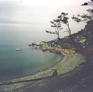
| Sunset in the port of Listvyanka, at the beginning of the Lower Angara | 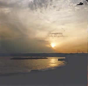 |
Baikal contains a lot animals, plants and microorganisms
that are unique. Some of them are species that usually can only be found
in salt water. Two examples for this are the Baikal seals and the Baikal
sturgeon. It is assumed that in prehistorical times it was connected to
the sea, then got cut off and slowly filled up with sweet water.
The special Limnological Institute that has it seat in Irkutsk, with a
branch in Listvyanka on the shores of the lake, is dedicated to the research
of Baikal. Among other fields of research it studies the development of
oceans as the tectonic changes Lake Baikal is undergoing resemble those
of the sea.
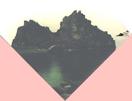
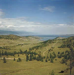 |
View from the western shore near Sakhyurta onto the "Small Sea" |
There are many small islands in the lake. Many of them
are mere rocks, serving birds as a breeding place, or seals as a resting
place. Many of them disappear in the course of time, others emerge. The
most important of these rocky islands are the Ushkanin Islands near the
"Holy Nose" peninsula.
The only big and inhabitated island is Olkhon, with some villages on it.
It houses quite a high mountain, mount Izhimey, with 1274 meters.
On the other side of the lake, north of the bigger settlement of Ust-Barguzin,
there is the "Holy Nose" peninsula, with also a few villages.
It’s connection to the land is swampy, forcing the people living
there to use boats for transport and displacement. Maybe one day the Holy
Nose will stop being a peninsula and turn into an island.
| Fog | 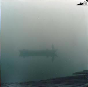 |
The name "Baikal" comes from the language of
the Buryats, the autoctonous people living around the Lake. It means "the
rich lake". The Buryats also refer to it as the "Holy Sea".
Among the Buryats living on the eastern side of the lake Buddhism had
a strong influence. The ones on the western side, the Pribaikalye, still
adhere to Shamanism. They have never been christianized, and the absence
of churches in their villages is an unusual sight to the traveller.
 |
The shore at Buguldeyka, a small camping resort |
When the Transsiberian Railroad was constructed between 1891 and 1907, it had no connection on the shores of the lake. Lake Baikal had to be crossed with icebraking ships. When the ice was too thick, between january and march, people and freight were transported in sleds across the lake. Later rails were laid across the ice.
From 1904 on the construction teams started to build the Circumbaikal trayectory that was initially planned to go all around the lake. This plan had to be given up as the obstacles proved too big. What remained were the line between Sludyanka in the South and Babushkin in the Southeast that still form part of the Transsiberian Railroad and a small gauge line between Sludyanka and port Baikal – where the Angara leaves the lake – that is some kind of tourist attraction and serves recreational purposes.
Nowadays transport across the Baikal in summer times is effectuated by "raketas", wing boats. You’re lucky if you catch them as they don’t go on schedule – for lack of fuel, as perhaps can be guessed already.
| View of Sludyanka, at the southern end of the lake |  |
 |
Port Baikal, opposite of Listvyanka, at the beginning of the Lower Angara |
The most important fish for food purposes is the omul. Many people live more or less on fishing this fine Baikal speciality. It’s preferedly eaten raw, but also smoked or cooked. Fishery also is down in comparison with former times, as the cultivation and breeding of the fish is neglected, because the authorities don’t care for it the way they did, if at all. And the ordinary fishermen live up to the credo "catch as catch can". So the waters close to the settlements are pretty fish-depleted and the fishers have got to go to more remote areas – which rises the cost of fuel.
| On the island of Olkhon, near Yelga, looking towards the "Small Sea" and the main land | 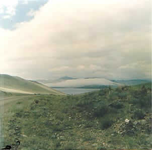 |
When I was there in 1997 I noticed a sharp deterioration
in living standards. In the village of Khuzhir, situated on the island
of Olkhon, there was no electricity any more. The habitants of Khuzhir
couldn’t afford the fuel that ran the generator which in Soviet times
supplied the village with electricity.
The water supply was also in question. The sweet water supply came with
a water truck that filled water from the lake with a hose in the various
containers people had set up in their houses or yards. The truck got the
water from a pump-house on the shore and people feared that one day the
pump might also stop to work for lack of fuel.
 |
The small bay near Khuzhir on the island of Olkhon |
The desperate situation of the region, as common in most
rural areas of former Soviet Union – no money, no fuel, no jobs,
bad supply, and no future – lead to a sharp rise in criminality and
alcoholism. People get drunk as much as they can on "sprit",
pure alcohol, and then sometimes commit the most atrocious crimes. When
locked up in prision, awaiting trial, they often get very little food
and the family has to provide them in order to keep them from starvation.
As a result of all this – among other things – traditions are
becoming unimportant.
In the bay of Khuzhir there is the Shaman mountain, the most important
place of Shaman worship among the Buryats. In the cave at the bottom of
this large rock there used to live practicing Shamans in former times.
Now, of course, it is deserted. The rock only serves for occasional popular
feasts where people from the whole Baikal area come to gather, worship,
but most of all: drink.
 |
|
| The "Shaman’s Mountain" in the small bay near Khuzhir. It contains a cave where the shaman alledgedly lived |
There is little industry on the shores of Lake Baikal, but the ones that have been established – still in Soviet times – contribute their fair share to the pollution of the lake and endanger the unique plants and animals of the lake. The worst factory in this aspect is the wood pulp plant in Baikalsk, in the Southeast. Originally built for military purposes it today continues to produce, polluting not only the water of Baikal, but also the air, the town itself and it’s surroundings. It faces little resistance, though, from the locals, as at least it provides employment for many of them, a scarce good in postcommunist Russia.
Many of those concerned hope that the
gigantic amount of water will counterbalance the harmful substances that
are being dumped into the lake by the factories and by one of it’s
main tributaries, the Selenga which also comes loaded with the waste of
various settlements situated along it. These "optimists" hope
that the "Holy Sea" will kind of swallow and digest the pollution
it is exposed to and thus serve as a kind of gigantic filter.
But it should not be forgotten that the water of Lake Baikal, due to the
fact that it has only one outlet, exchanges itself very slowly, therefore
the pollution accumulates, also very slowly, and it might well be that
in some decades the lake collapses …
| Sunrise on Lake Baikal, seen from the western shore near Port Baikal. | 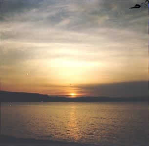 |
(Photographs from 1997. Report written in 2003)